
With GeoLab, FUTURE Group provides its clients with specialized and tailored solutions, from the acquisition and processing of territorial information, based on geodesic reference systems, using classical topography, global positioning systems (GNSS), mobile mapping and laser scanning or remote sensors, aiming at the production of geographic information, in the form of metadata or cartography, for use in various study and project platforms, including GIS and BIM.
We are specialists in laboratory tests of soils, aggregates, concrete and bituminous, studies and analysis of construction materials behaviour, innovative in the services of geotechnical and geophysical investigations, through non-destructive methods, using the Ground Penetrating Radar (GPR) technology, also known as GeoRadar.
Innovation and novelty are part of Future, as well as of the solutions that the Group makes available at the service of geotechnics and geotechnology.


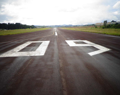
63 REGIONAL AIRPORTS IN THE STATES OF MINAS GERAIS, GOIÁS, RIO DE JANEIRO, ESPÍRITO SANTO, RONDÔNIA AND MATO GROSSO
Contract of extended scope, corresponding to the development of engineering projects in 63 airports in Brazil.BRIDGE REHABILITATION PROJECTS OF BR 101/PE, BR 408/PE AND BR 232/PE
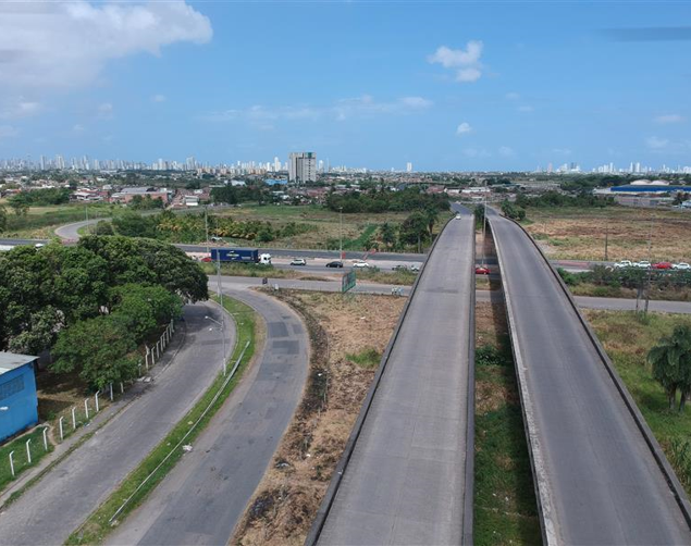
Special structures of the Brazilian Federal Roadways (BR's) are elements that have the purpose to overcome obstacles, such as avenues, valleys, or rivers.BELÉM / VAL-DE-CANS INTERNATIONAL AIRPORT – DNIT/PE
Specialized Technical Services for Topographic Surveying, Drilling and Geotechnical Testing, in the stages of Services and Preliminary Studies, Basic and Detailed Designs related to the adequacy of Belém / Val de Cans International Airport, Belém, Pará.63 REGIONAL AIRPORTS IN THE STATES OF MINAS GERAIS, GOIÁS, RIO DE JANEIRO, ESPÍRITO SANTO, RONDÔNIA AND MATO GROSSO
Deflectometric surveys were carried out using FWD, pavement scanning of runways, taxiways and aircraft parking yards using GeoRadar and geotechnical tests execution.
Services:
Cadastral survey; drilling and geotechnical testing with FWD and GeoRadar surveys.
BRIDGE REHABILITATION PROJECTS OF BR 101/PE, BR 408/PE AND BR 232/PE
Special structures of the Brazilian Federal Roadways (BR's) are elements that have the purpose to overcome obstacles, such as avenues, valleys, or rivers.
Services:
Topographical and Cadastral surveys using Drones.
BELÉM / VAL-DE-CANS INTERNATIONAL AIRPORT – DNIT/PE
Specialized Technical Services for Topographic Surveying, Drilling and Geotechnical Testing, in the stages of Services and Preliminary Studies, Basic and Detailed Designs related to the adequacy of Belém / Val de Cans International Airport, Belém, Pará.
Services:
Preliminary Services, Studies, Topographical Surveys, Drilling, Geotechnical Tests, Structural Assessment and Preparation of Engineering Projects in Service and Preliminary Studies stages, Basic and Detailed design of the airport Infrastructure.
